Translated from the original article: http://gonano.eu/summer -solar-bike-stage-in-the-dolomites
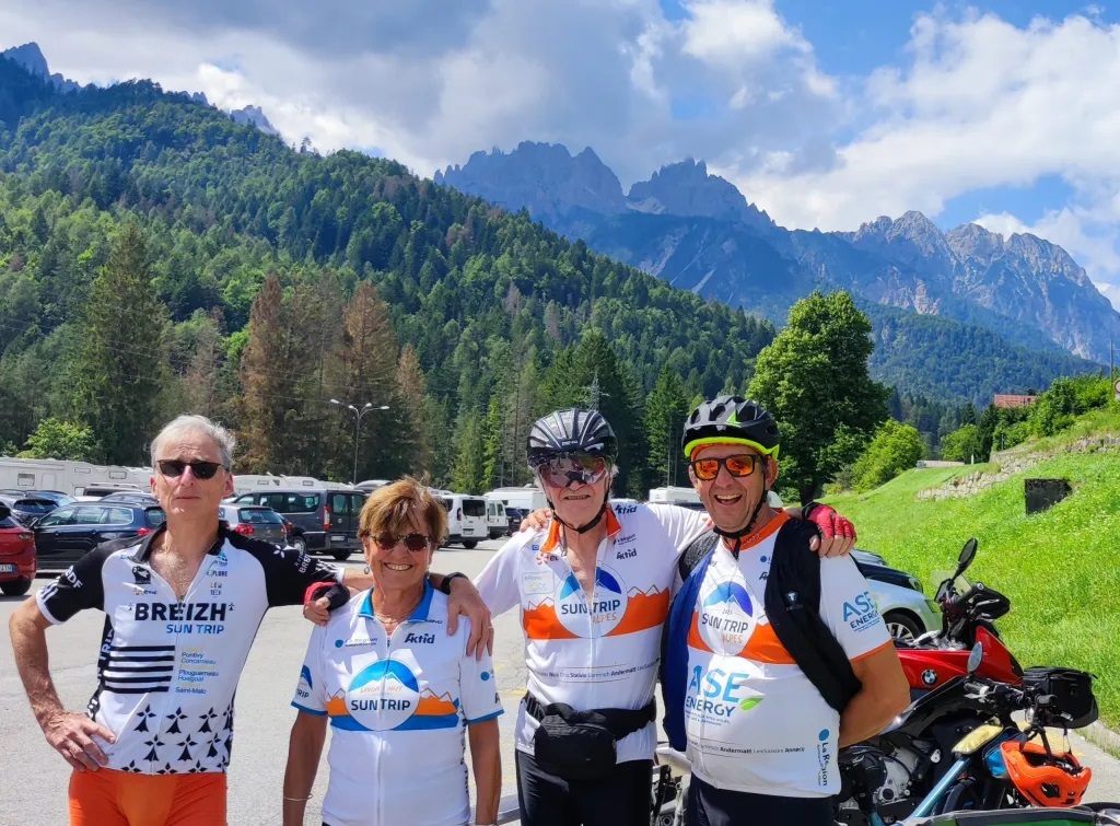
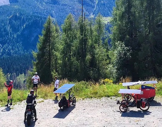
Cycling tours with Paul B.
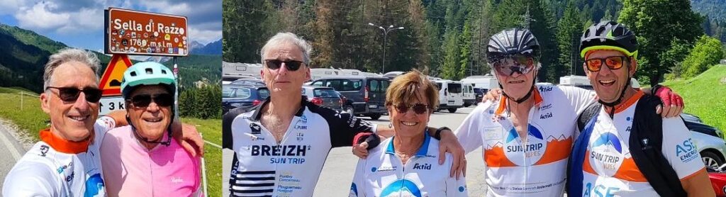
Paul joined Daniele in Osais in mid-July, he came with his VAE because he didn’t have was possible to bring your tricycle solar.
Route 1
Climb to Casera Razzo ( 20 km long and 1000 m of positive elevation gain, average 5%): this is the main direction to go from the Val Pesarina valley to other destinations.
GPS track: https://www.strava.com/activities/12044565220
https://youtube.com/shorts/Vu-Rw_pDuD8

Course 2
As far as Lake Sauris (almost 80 km, 1,500 m of positive elevation gain).
GPS track: https:/ /www.strava.com/activities/12044566252
After a few outings ” d’ one day”, we wanted to try longer routes.
Course 3 over 2 days
In total there were about 180 km and 3000 m of positive elevation gain
Day 1: From Osais to Cortina d’Ampezzo
GPS track: https://www.strava.com/activities/12044566144
Day 2: From Cortina back to Osais
GPS track: https://www .strava.com/activities/12044566248
https://www.instagram.com/p/C92pP6AITB2/
GPS track: https://www.strava.com/activities/12248387065
It was almost 80 km and 1600 m of positive elevation gain.
Course 4
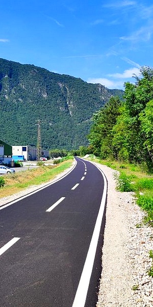
Unfortunately, last winter, the road over the Monte Croce Carnico pass was closed due to a major landslide: the closest road to Austria was still blocked. So we decided to go to Tarvisio (on the border with Austria) anyway by following the Alpe Adria cycle path from Carnia, a small village near Tolmezzo.
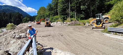
A total of 100km and 700m of elevation gain: what a nice surprise to discover the addition of 5km to the Alpe Adria cycle route a few days before (see photo below)! The weather was very nice and sunny, but extremely hot, 37C° most of the time!
GPS track : https://www.strava.com/activities/12044565994
https://www.instagram.com/p/C9-I31FoaF_
Hiking
When it was too hot to cycle, we did some hiking in the surrounding area. Here is a video of our climb to the famous MONTE LUSSARI (1200m altitude) which was also a stage of the Giro d’Italia 2023.
https://youtube.com/shorts/4R3UuYkw2fs
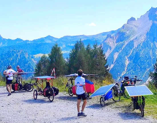
Cyclo-randonnées avec Gilles et Joséphine R. qui ont amené leurs tricycles solaires
Just the night before their arrival in Osais, a very violent storm unfortunately caused a huge landslide a few km after Osais in the direction of Casera Razzo. The road was cut off. As a result, we had to re-plan different routes, which left us with much less choice than usual…
Course 1
In total a little over 70km and 1360m of positive elevation gain.
GPS track : https://www.strava.com/activities/12248384912
https://youtube.com/shorts/XzYhjKH7cvU
Course 2
“Forni di Sopra” in another parallel valley. 100 km and 1500 m of positive elevation gain.
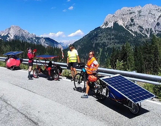
Reunion with Hervé and Christiane who came from Marseille by solar bike to join Osais
GPS track : https://www.strava.com/activities/12248385106
https://youtube.com/shorts/UTThkmUMpn8
Course 3
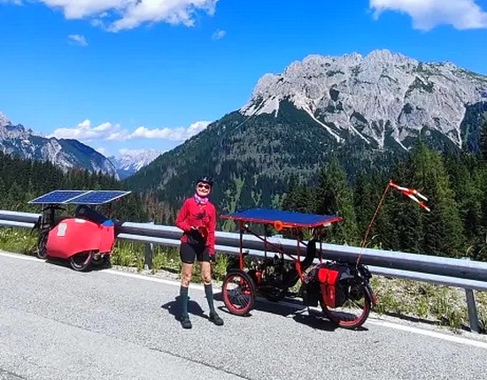
The road up to Casera Razzo being closed, we travelled to Sauris via the other side, through the tunnels. In total it was less than 100km with a 1600m difference in altitude. When we arrived at the artificial lake of Sauris, Gilles encountered a mechanical problem with his rear wheel: fortunately he was able to repair it, continue with us and return to Osais without incident!
Trace GPS : https://www.strava.com/activities/12248385575
https://youtube.com/shorts/VAAzDbq7GAk
Hervé tried to see if he could get through the “closed road” with his bike. And without too much trouble, he was able to get through the barriers and ride about 1 km of dirt road…. This was very good news for the outing we had planned for the next day!
https://youtube.com/shorts/R44_OEdWj2M
Course 4
So we planned to go (again…) to Sauris but this time starting from the Casera Razzo climb by the “officially closed” road. Fortunately, it was a public holiday so no one to check the works. After having lunch at Sauris di Sopra we split into 2 groups: Hervé, Gilles and Christiane left by the same route, going up towards Casera Razzo, Joséphine and myself continued down the Sauris valley, passing through Villasantina and back to Osais to do a complete tour. It was almost 80 km and 1600 m of positive elevation gain.
GPS track : https://www.strava.com/activities/12248387065
Course 5
The next day, as the weather was very changeable, we had planned a relatively short excursion to Sappada only with Gilles and Joséphine. The preparation before leaving was always fun. Here is a video of Hervé’s drone just before our departure: https://youtu.be/dBbRVyXaH24 A little less than 64 km and 1160 m of positive elevation gain to reach this very pretty village which was a stage finish of the Giro d’Italia 2024!
GPS track: https://www.strava.com/activities/12248385813
Course 6
Another exit to Ravascletto, going down to Tolmezzo (the main town in the area) and back. A shorter exit than usual (60 km) but still 1000 m of positive elevation gain.
GPS track: https://www.strava.com/activities/12248386615
Course 7
It was time for everyone to leave. I accompanied Hervé and Christiane to Lubljana where they had planned to meet his daughter. We left in the direction of Tarvisio and took the Alpe Adria cycle route: we had lunch together at the old Chiusaforte train station. Then they continued north and I returned alone to Osais while Gilles and Joséphine returned to France.
Bilan
In any case, we always had a LOT OF FUN riding together! It was a great experience to be able to ride all together with our solar bikes. We met a lot of people, always very curious about our bikes and very supportive of this type of solution. We would have liked to organize longer rides but unfortunately several closed roads forced us to plan shorter/closer routes. A big thank you to Paul, Hervé, Christiane, Gilles and Joséphine who came to the Dolomites! We hope to be able to organize a similar stage again in the near future, when all the closed roads have been reopened!
Extrait et traduit de l’article original : http://gonano.eu/summer-solar-bike-stage-in-the-dolomites